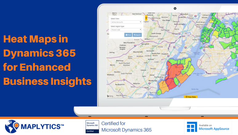
Heat maps are one of the most powerful data-analysis tools available for business intelligence. When organizations use geolocations of the Dynamics CRM data to create heat maps, they can get precise geographical insights that enable better business decisions. They can analyze data like open opportunities in the regions or density of records on a map within Dynamics CRM/Dynamics 365 Customer Engagement using the defined geographic boundaries.
With Heat Maps, organizations can visualize Dynamics CRM data on a map in a way that is easy to analyze. Below are the two primary business use cases for Heat Maps in Dynamics 365 CRM;
1. To Analyze the Geographical Aspect of Dynamics CRM Data:
Businesses use Heat Maps in Dynamics CRM primarily to get a geographic representation of their enterprise data for improving their Sales, Service and Marketing processes. For example, a Sales or Field Service Manager can use heat maps for a complete overview of the geographies to identify high-potential regions, spot patterns, identify trends, and strategize to maximize the output from the territories. Moreover, heat maps can also be used by the Marketing Teams to monitor the regions for efficient distribution, targeting the right audience and improving the ROI of the marketing campaigns. For example, finding the right location to host an event for all the accounts belonging to the Banking Industry with annual revenue greater than 500K. Heat Maps will help to identify the density of these data points in a particular region.
2. To Improve the Internal Processes:
Sales and Field Service Managers can use Heat Maps for monitoring the performance of the team in the territories to improve the internal sales and service process. Managers can also supervise and analyze the year to date sales performance of the sales reps on a Heat Map directly from the Analytical Dashboard for enhanced reporting. When working on territory realignment, Sales Managers can use the insights from Heat Maps to identify high and low potential areas for most efficient distribution of their sales force.
Maplytics™ is one of the leading geo-analytical mapping apps that provides powerful data visualization capabilities within Microsoft Dynamics 365. Maplytics is one of the first multi-language mapping apps to be Certified for Microsoft Dynamics 365 (CfMD). Apart from Heat Maps and analytical capabilities, Maplytics offers powerful features like Appointment Planning, Radius Search, Territory Management, Route planning and more to take your MS Dynamics CRM visualization to an entirely new level! Maplytics currently supports English, French, German, Portuguese, Spanish and Turkish.
Get your free TRIAL today from the Website or Microsoft AppSource!
Happy Mapping!


