“You make tools available for a passionate person and he would thank you with improved productivity”, said a wise woman
Maplytics, the 5-star rated geo-mapping app of the Microsoft AppSource has created the feature of Radius/ Proximity Search with such hardworking and passionate users in mind. If used well, it acts as the best tool for nearby lead generation. Excited to know how? Let’s dive in!
Use Case
Amber, a senior Sales Rep for a B2B company is driving toward her meeting location when there is a notification on her phone. There is an email from her meeting host. Thinking it must be something very important she parks the car at the side and opens her laptop to check the entire mail thoroughly.
Hi Amber,
Apologies for the inconvenience!
Due to a Fire Drill in our office, we are evacuating it immediately. I missed the mail regarding the same before committing to this appointment. Kindly reschedule for the coming week.
Thanks
Ronan Wilson
Mr. Wilson had canceled the meeting due to a fire drill in his office building but Amber was just 6 minutes from the venue. She had no other meetings post this, so, she could end her day, early. But Amber is too passionate about her work and she decided to utilize her extra time. Amber parked in a nearby parking lot and worked on her laptop. She opened Maplytics within Microsoft Dynamics 365 CRM and went for Radius/Proximity Search.
Users can search for nearby records around a required location using Proximity Search. This helps them understand the proximity of the nearby records in regard to the selected location. There are two different options to perform a Proximity Search-
- Proximity by Distance
- Proximity by Time
Current Location: Users can select any location or a record as the current location. This is used to specify the center point for the Proximity search. By default, this field displays the address stored in the Maplytics personalized record of the logged-in user. This is always represented by a green color pushpin on the map and also indicated right next to the current location message box.
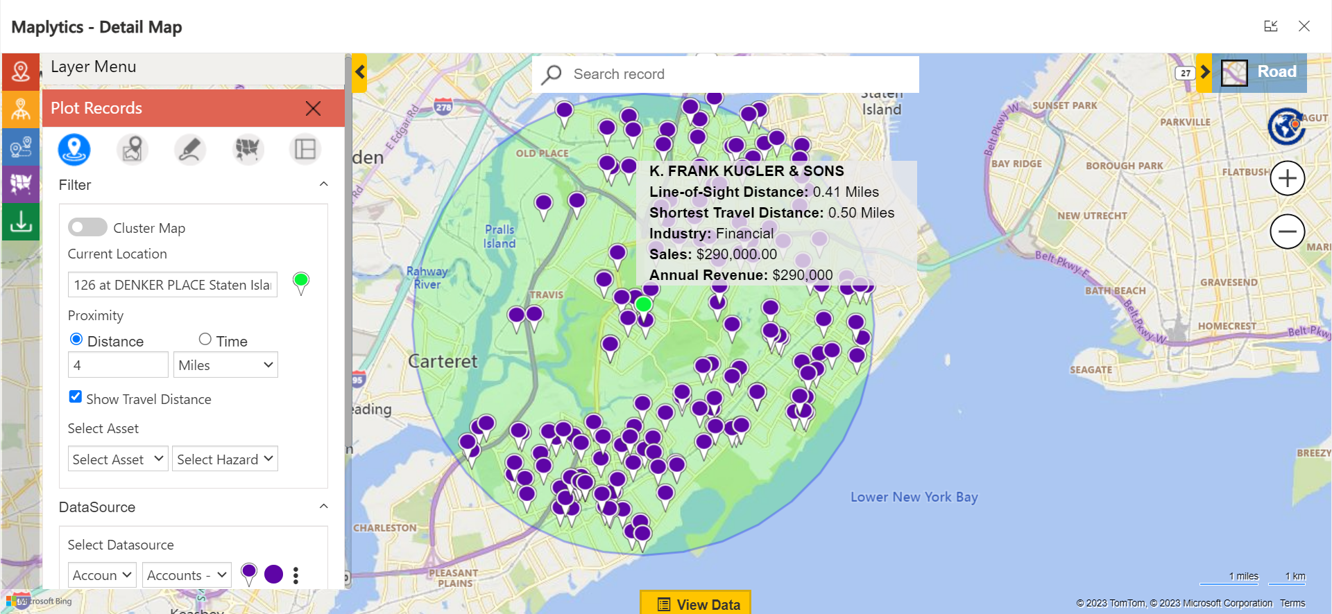
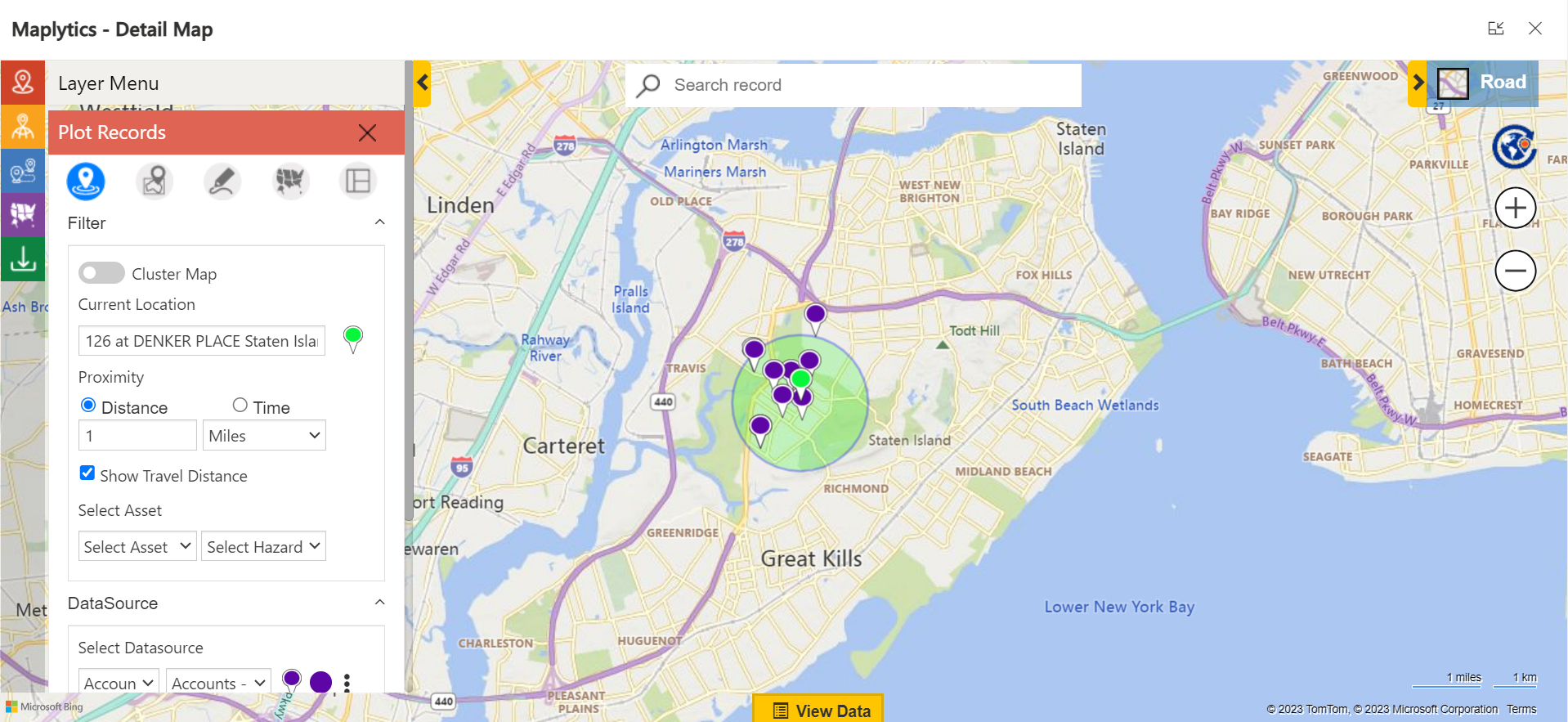
This option calculates the straight-line distance between the current location and all the points which fall in the proximity parameter as shown below:
Proximity by Distance
The users can then enter the radius for the Proximity search. They can also add decimal values with a scale of 2 for the radii. The Proximity can be provided either in Miles or Kilometers. The User can also hover over a pushpin and see the distance from the current location selected.
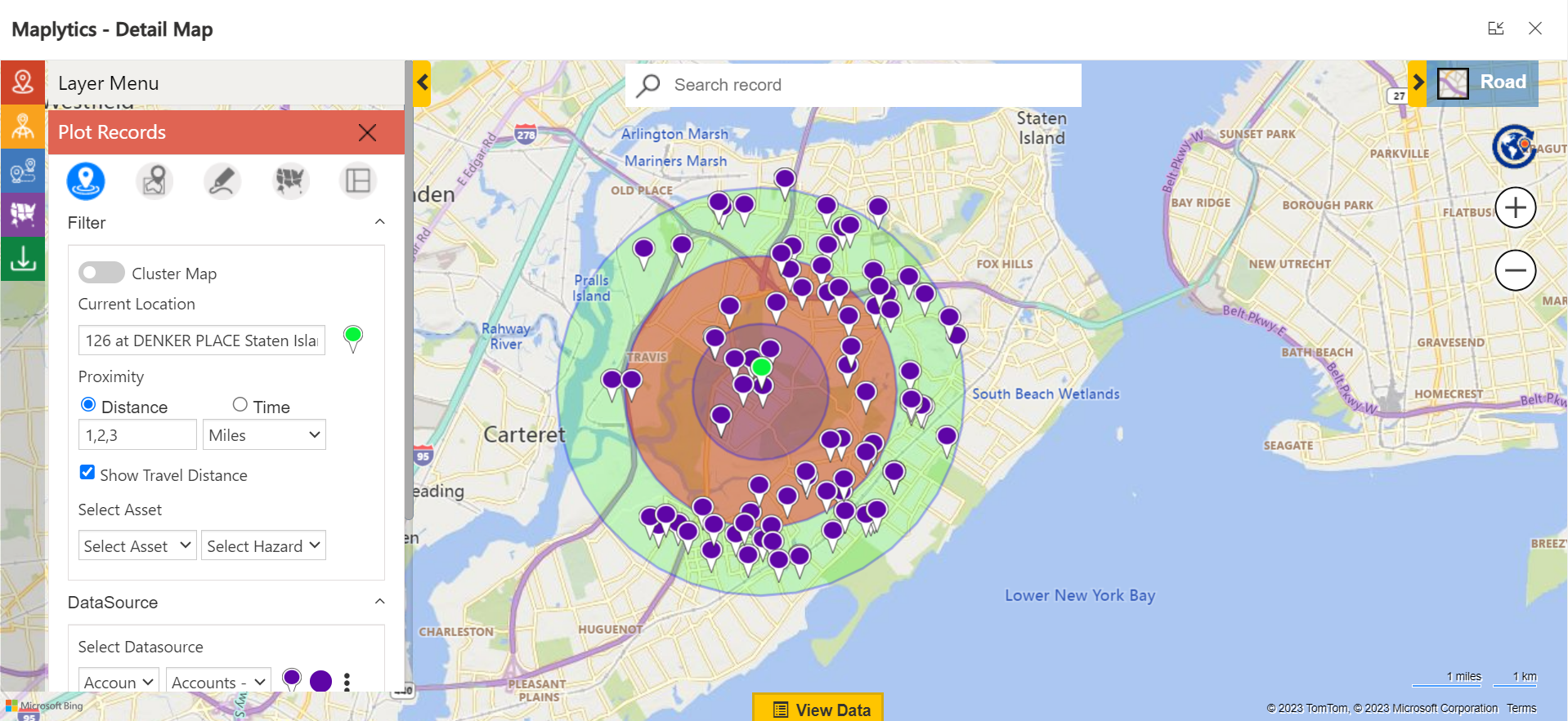
Amber, in this case, puts her current location as Denker Place and her radius as 1 mile. She is doing this with the aim of viewing the potential leads around her at that moment. Had she wanted to travel around with a specific time in mind, Amber would have provided the number of hours with or without traffic for visualization.
Proximity by Time
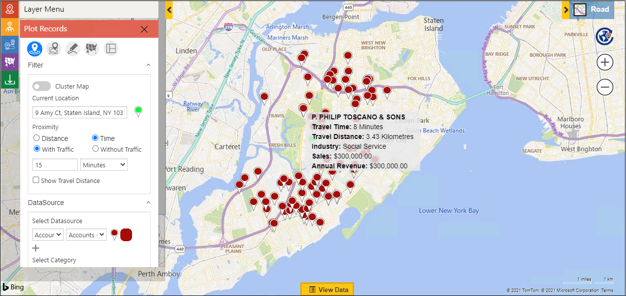
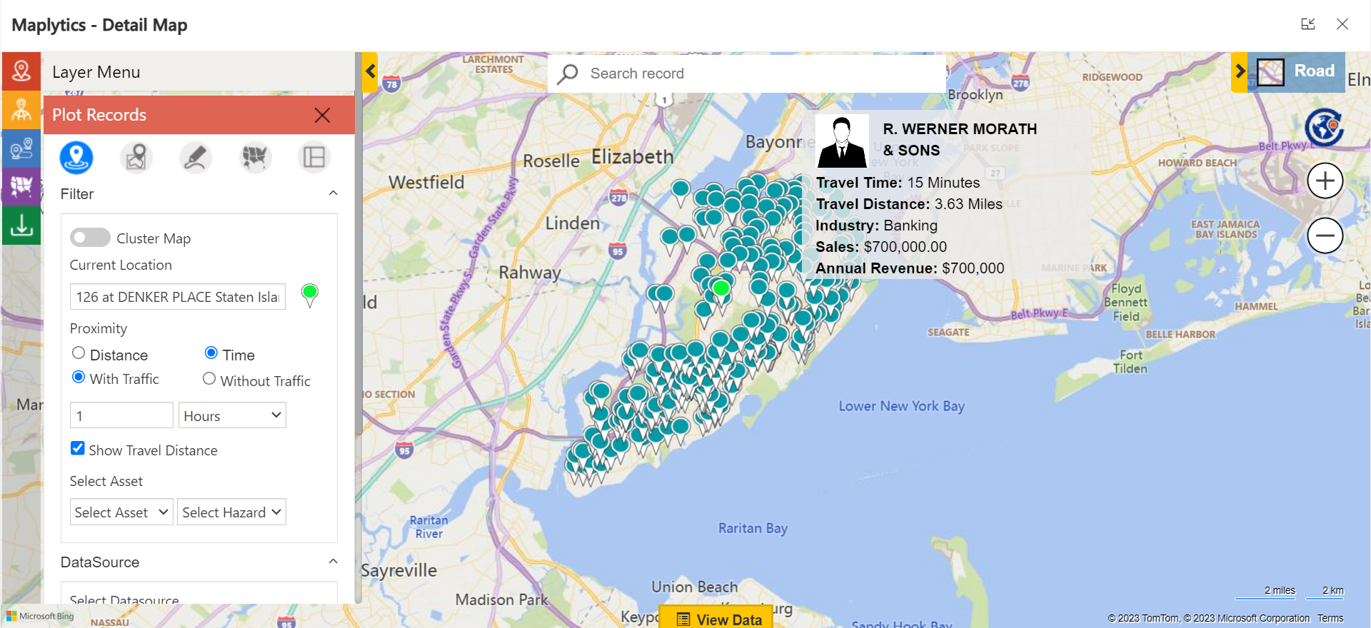
This option calculates how many points fall in ‘x’ minutes or hours of driving distance from the current location. The Proximity can be provided in either Minutes or Hours. The User can also hover over a pushpin and see the distance from the current location.
Amber decides to check once, what all leads fall within an hour of travel from her current spot and she lands up with the following-
Deciding from so many options is a little difficult, so, Amber decides to explore within the Proximity by Distance option.
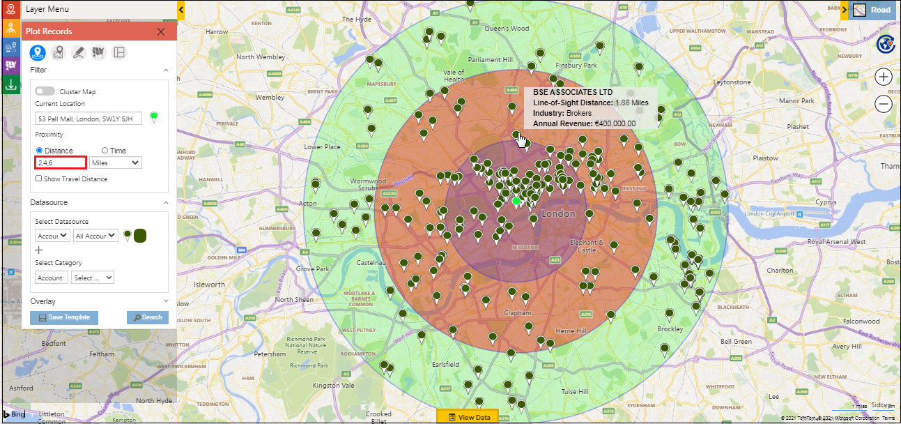
Concentric Proximity Search
This addition to Proximity based on Distance allows users to perform up to 3 proximity searches simultaneously. The user needs to enter the distance values separated by a comma (,) and all the points that fall in the defined proximity parameter will be plotted.
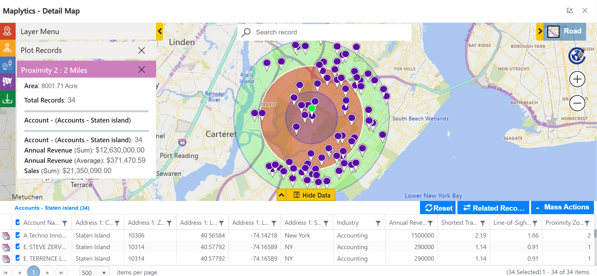
The Concentric proximity zones are represented by different colors for easy visual analysis. The users can click on individual proximity zones to highlight the circle and open the Summary Cards for it. The user can also filter the data points based on the proximity zone and their proximity distance from the current location in the ‘View Data’ grid.
Note: User can enter integer value from 0.1 to 2000 for distance proximity search
Show Travel Distance
While performing a Proximity Search by Distance or Time, if the users want to see the actual traveling distance from the current location to each of the individual pushpins, they can select the checkbox of ‘Show Travel Distance’ to view the Shortest Travel Distance on the hover and view data grid.
The leads falling within the 1-mile travel category weren’t available for an impromptu meeting. Hence, Amber decided to explore more leads within the 2,3 miles radius.
She finds 34 records within the 2 miles category. Thus, checks with them and fixes up two meetings, one for the day and another within the upcoming week.
In this way, Amber locates sales leads around her and increases her productivity.
What’s More?
The unique features of Maplytics could be experienced when explored more with a trial. One can write to the Team at crm@inogic.com for mapping requirements, a free trial of 15 days, or a personalized demo within Microsoft Dynamics 365 CRM / Dataverse.
To learn more about Maplytics, its applications across industries, and another multitude of features, do visit the Website or the Microsoft AppSource. For further details, one can hop on to the Blogs, Client Testimonials, Success Stories, Industry Applications, and Video Library for a quick query resolution.
Until then,
Happy Searching!


