With our variety of features, we have always tried to cater to all the Maplytics users who belong to different industries, businesses, and work profiles. One can use different features of Maplytics like Routing optimization, Proximity search, Territory management, Overlay, and many other features, which help them to fulfill their daily tasks for various departments in the organization. In our last April 20 release, we have worked more on the Routing Optimisation to make it more useful for the Logistics and Distribution departments as well. Most of the Logistics companies work with heavy vehicles likes truck to load the goods and carry it from one place to another.
This is why to help them get the most suitable routes for their logistics, we have added another option of choosing Truck as the vehicle while they plan an optimized route or search for records within Proximity from a location.
Let’s understand the use of this feature with a use case. Katherine is the Logistics and distribution manager of her Company ‘NatureBee’ which supplies organic Fruits and vegetables. She has been using Maplytics to see the color-coded pushpins for her customers plotted on the map categorized by the Contract duration to analyse the status of the Customers and the contacts done with them for the supplies. She further analyses the information of the customers to understand which customers need the delivery of the supplies. To deliver the organic foods to her customers as per their requirement, Katherine uses Routing optimization within Maplytics to create routes for her drivers who would be driving to the customer location to deliver the supplies. Let see how Katherine uses the feature of the truck route to create routes for her drivers.
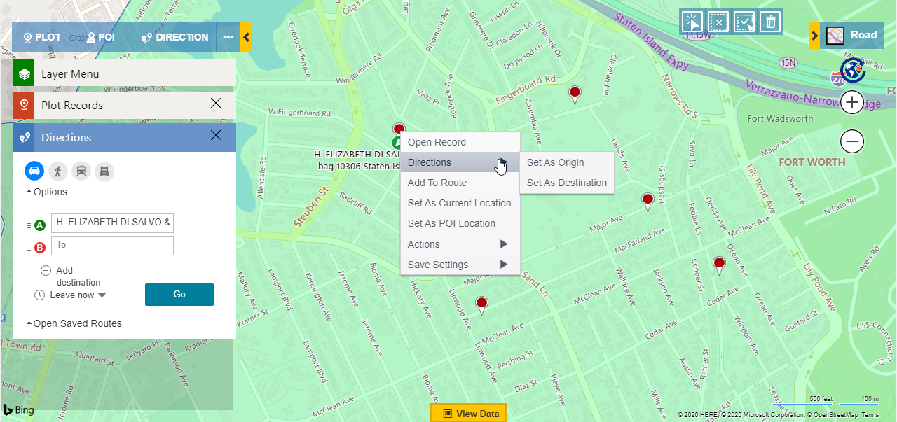
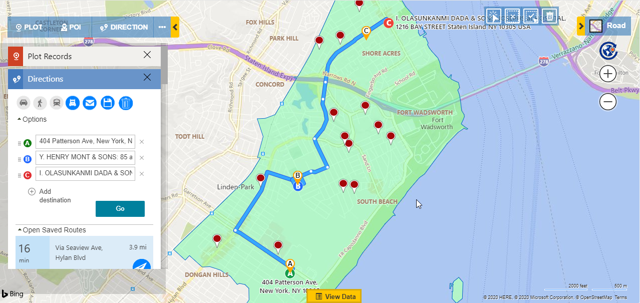
Katherine first plots the Account entity which contains the records for her customers with whom they have got the contracts signed for the deliveries. Now she selects the waypoints by right-clicking on the pushpins to select the record’s locations as a waypoints.
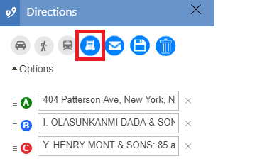
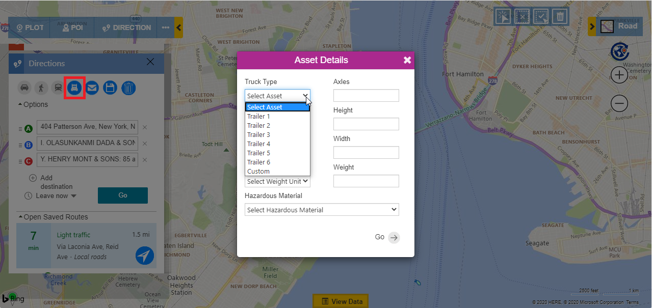
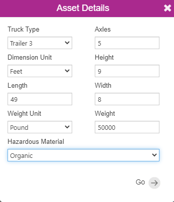
After selecting the required records as waypoints, she clicks on the icon of the truck, which gives her the option to select the Truck type from the list of the sample Assets.
She can choose any one of the sample assets or can click on Custom to enter her desired dimensions for the truck.
This will allow her to enter the following details for their truck:
- Axles: The number of axles in the truck
- Dimension Unit: The unit of measurement of width, height, length that can be in either Meter or Feet.
- Height: The height of the truck.
- Length: The length of the truck.
- Width: The width of the truck.
- Weight Unit: The unit of measurement of weight that can be in either Meter or Feet.
- Weight: The weight of the truck.
- Hazardous Materials: List of one or more hazardous materials for which the truck is carrying. For example Combustible, Flammable, Organic, etc.
Here Katherine selects trailer 3 as the Truck Type and Organic as the Material and clicks on ‘Go’. This creates an optimized route for driving by the truck based on the dimensions Trailer 3 truck type.
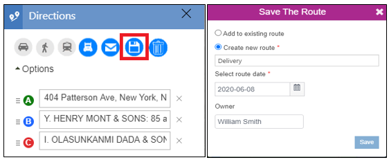
She now clicks on the Save button to save this route and assign it to her driver William, who will be delivering Apples and Oranges to the two Customers as per their required quantities.
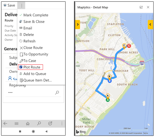
Once Katherine has assigned the route, William can easily open the route in the mobile/tablet from the Activities within Dynamics CRM and can plot the same on the map to view the route and redirect himself with the Navigation button.
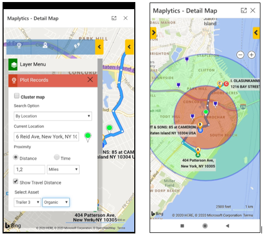
Now, William realizes that some crates of oranges are less in his truck and now he wants to see if there are any of his colleagues in the vicinity of his current location and if they have some crates of oranges available in their truck which he can borrow and load in his truck. So, to search for it, he clicks on the Locate me button to plot his current GPS location of the mobile as the current location on the map. He further selects the ‘Show Travel distance’ option on the plot card, enters 1,2 miles as the radii, and selects the Trailer 3 as the Truck Type and Organic as the Hazardous material. He selects the custom entity which saves the coordinates the trucks at specific timings coming from integration with the GPS devices on the trucks. Once he clicks on Search he will get all the trucks plotted on the map which are within the vicinity of his current location. He can see that there are some trucks that are within the vicinity.
He sees that Brian is in his vicinity and is reachable. So he calls Brian and shares the situation and creates a route to reach to Brian, updates his current route and goes to Brian. He takes the required crates from him and loads in his truck. Once he gets the required crates, he follows the rest of the route and delivers the crates to the customer.
Thus, with the help of Maplytics Katherine was able to create an optimized route based on the specific dimensions of their trucks and assign it to her team and the team can follow the routes efficiently to complete the deliveries.
Contact us on crm@inogic.com for a quick demonstration of truck routing based on your use cases. Please go through our blogs to know about other features of Maplytics. Do share your feedback and suggestions with us.

