We would like to thank all our valuable Partners and Customers for always considering Maplytics as a Preferred app for their Geo-Analytics needs and constantly showing their appreciation and support for their favorite maps integration app within Dynamics 365 CRM / PowerApps (Dataverse). The feedback served as a huge motivation for taking Maplytics to higher levels. We have been working diligently to make Maplytics even more advanced with the features that we brainstorm along with all your valuable suggestions and feedback. We are ready to release another big Milestone for Maplytics!
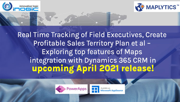
In this release, we have focussed on almost all aspects of enhancing our product, from adding something new to enhancing something existing along with increasing the user-friendliness of the product. Let’s have a glance at the highlights of the features to be released in our upcoming April 2021 release.
Real Time tracking in Field service
The most powerful feature of our upcoming release will be Real Time tracking of your Field reps. Users can use this feature in field service to track the location of field technicians in real-time. This feature will show the route followed by the field technicians in real-time as well as provide the location history of any field technician who has traveled on the field in the past. Thus, the team managers can track where did their technicians travel on the field on a specific day and plan their future assignments accordingly.
Territory assignment rule
Last year we added advancement in Territory management by introducing automatic territory creation based on the auto-balanced distribution of the count of records. This year we have worked on advancing our Territory assignment process as well. With great demand for assigning territories to the records based on defined rules, we are glad to add this feature in Maplytics. With this, admins can create simple or advanced rules with required conditions based on which the territories will be assigned to the records that satisfy the conditions. This way if any organization follows a certain process of classifying the records and wants to assign respective territories to appropriate records, they can use this feature of Territory assignment rules to create their own rules to assign territories to the required records as per required conditions.
Land Area Mapping
With the increasing demands of Maplytics into various industries, we are glad to support one of the major aspects of the various industries dealing with land plots or fencing of properties as well with our latest feature of Land Area Mapping. This feature will help the users to visualize the area of agricultural, residential, commercial properties etc. on the map. Users can define the area of the land in Maplytics for the respective entity record and then visualize the same on the map. This feature will help the users to analyze the regions for each client, agent, farmer, etc. on the map. One can visualize the land along with the respective pushpins as well as if dealing only with land then they can also visualize just the land on the map without any pushpins for the same.
Enhancement in Check-in
For every organization that has a team working out on the field, our existing feature of check-in becomes one of the most useful features to track the activities of the sales/service team on the field. Using Check-in, field professionals can register their arrival and departure for their meeting locations. While the field professionals are checking out for any particular meeting, if they need to add any notes like MOM, requirements of the clients, or order of the product, etc., they will now be able to do so with the option of adding notes while Checking out for the respective meetings. These notes can later be viewed within the timeline of the respective record. This will help the field person as well as the respective managers to keep an eye on the history or important findings on the meetings of the field team with the clients.
In certain cases, while a field professional had to meet a client on an offsite location or let’s say they missed checking-in/out for any particular meeting, they will now be able to create pending check-in/out requests for the past meetings to report to their managers about the respective meetings they attended in the past. The respective managers or the admins can further approve or reject their requests for the check-in/out records for the past meetings.
Pushpin selection directly on the card
Taking the user-friendliness to another higher level, we have now added the ability to select the required pushpins for the views or categories right on the map. While visualizing any views of any entity on the map, a user can select the required pushpins and respective colors on the ‘Plot Records’ card itself which will simultaneously be updated on the map in real-time. This will help the user to better visualize the records with desirable pushpins on the map. Along with this, while visualizing categorized records on the map, the user can select the required pushpins and respective colors for the categories plotted on the map within the ‘category’ card. Users can further save the selection of pushpins right from the ‘category’ card for their future use as well. This way every user can have their configuration of desired pushpins for the various categories of the entities they work with.
Detail map control
In this release, we have added more Maplytics features to be accessible from Detail map control itself along with the previously added features. Now users will be able to categorize a single entity based on multiple categories. Apart from this, while creating a route, users will now be able to save the created route and also open any existing route on the Detail map control from the ‘Directions’ card and further print the route for their reference. While they are out on the field following the route using the turn-by-turn navigation within Google or Waze app, users can also use the feature of Check-in/out to check in or check out for the respective meetings.
Enhancements in territory visualization
In many organizations that use hierarchical territories within Dynamics 365 CRM, the users will now be able to visualize multi-level territories on the map as well. For example, if a territory is created for the USA which also has child territories for Arizona and Illinois, in such cases the territory manager and member of USA territory will also be able to visualize the child territories of Arizona and Illinois. This will help the users to have a view of all the levels of territories that they are responsible for.
With a huge team of field professionals, organizations tend to have a huge number of territories, in such cases to let the field professional visualize their territories easily, Maplytics will now by default let the users visualize only those territories for which they are responsible, however, admins can use the option of ‘Show All Territories’ to allow the users to visualize all of the territories that are created in the CRM.
This is just a short preview of the entire package of the new release, do follow our blog to get the latest updates on our upcoming release of Maplytics. If you would like to try Maplytics, you can download it from our Maplytics website or Microsoft AppSource. Also, feel free to connect with us at crm@inogic.com and how we can work together to cater to your Location intelligence needs within Dynamics 365 CRM / Dataverse.


