Territory management is an important part of a sales process but getting the right territory management tool is a difficult process. Maplytics, a 5 star rated Microsoft AppSource preferred geo-mapping app, comes with the best of territory mapping features to help the users build optimal territories in Dynamics 365. From advanced Territory assigning and managing features to territory visualization features, Maplytics is your one-stop solution for all your territory mapping needs.
In our previous blog, we saw how Maplytics helps to create multiple territories automatically. With Maplytics, it becomes really easy to create territories in Dynamics 365 CRM for field sales/service people based on postal code, cities, counties, any drawn shape, or from a shape/excel file. It also gives the ability to manage territories right from the map.
Once the territories are created and assigned to the respective Territory managers, the respective territory managers will be able to view the territories they are responsible for on the map using the option of ‘By territory’. As most of the organisations manage their territories so that the sales reps should be able to visualise their territories that they are responsible for, with the option of ‘By Territory’, the user will be able to see only the territories for which they are assigned as territory managers or its members. If the organization is using the Hierarchical territories the Territory manager and the members will also be able to see the respective child territories.
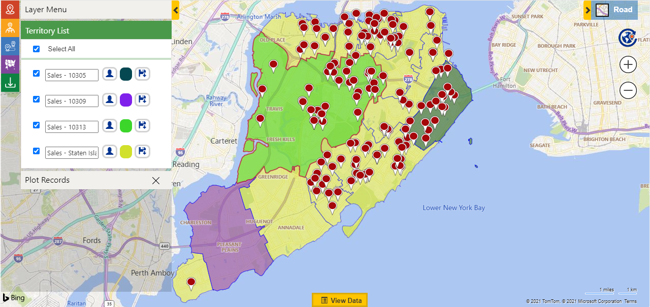
In the below screenshot, the logged in user William is able to see the parent territory ‘Sales-Staten Island’ and the child territories ‘Sales-10305’, ‘Sales-10309’, ‘Sales-10313’ as he is the territory manager of the parent territory ‘Sales-Staten Island’. William is not able to visualise other’s territories.
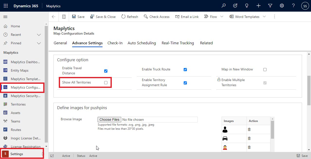
However, if the admins want to make all the territories visible to all of the users, they can do so using the option of ‘Show All Territory’. Maplytics admin or System admin can follow the steps below to do so.
Go to the Maplytics App > Settings > Configuration details > Default configuration detail record > Advanced Settings > Configure options > Select ‘Show all Territories’. This way, the users can view all the territories that are saved in the CRM’s territory entity even if they are not the respective Territory manager or the member.
This way, an organization can decide whether they want to restrict the visualization of the territories to the respective manager or member of the territory, or they want to let the users view all the territories regardless. The users can further view their territories and the clients they are responsible for on the map and work on their sales/service process to provide the best to the clients and hence improve sales.
Start using Territory management within Maplytics to build optimal territories in Dynamics 365, edit territories in Dynamics 365 and manage the territories for your sales/service teams easily and quickly as per the requirements. Help your Sales Team to have a better understanding of the clients they are responsible for, so that they serve their prospects and customers and give their best productivity to achieve the targets.
Browse through Maplytics Docs for any assistance needed in setting up Maplytics or feel free to email us on crm@inogic.com to discuss your specific needs for Maps integration within Dynamics 365 CRM/Dataverse.


