Maplytics August 2017 Release incorporates new personalization options to allow users to personalize Maplytics as per their needs and preferences. Previously the Map Configuration was applied on the Organization Level, but with the new release, we have made this configuration available on a User Level and have added few more settings for further customization!
Users can now get the things that they use the most and define their configuration to set the home page for Maplytics functionalities (Detail Map, Heat Map). Users can also specify the default Map type, distance unit, Map Center, Heat Map type, etc.
Steps to configure personalization for Maplytics:
Navigate to Settings > Maplytics Configuration Details > here the user can find the records related to each user added in Team Maplytics. Select the required record and modify the setting as shown below;
Note: Please don’t delete the first record where no user is assigned. This contains default information which is required to add new members to Team Maplytics. To delete Maplytics Configuration record for any user, please remove the required user from Team Maplytics. This will auto-delete the record from CRM and to add a record; please add the required user to Team Maplytics.
Here the users have multiple options to customize Maplytics based on their individual preferences. The options available are as follows;
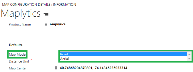
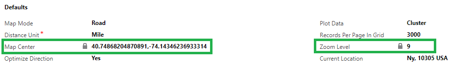
1. Map Mode: This provides the option to load Bing Maps within Dynamics CRM in default mode. Available options are Aerial and Road.
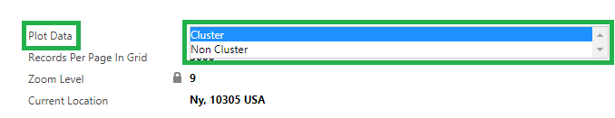
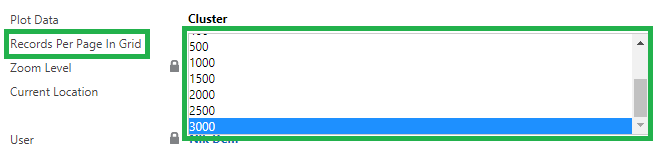
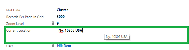
2. Plot Data: This helps the user to define the default plotting of data. The user can choose from the following available options;
a. Cluster: This will group nearby data
b. Non-Cluster: This will plot CRM data as individual pushpin
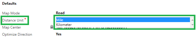
3. Distance Unit: The user can select the default option for distance measuring. Available options are Miles and Kilometers.
4. Records per Page in Grid: The user can select the number of records to be visible in Maplytics ‘View Data’ grid.
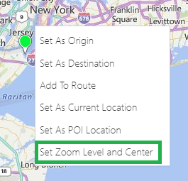
5. Zoom Level and Map Center: Zoom Level and Map Center will define the default location to zoom when the Detail Map is opened.
This is set from the Detail Map screen using the ‘Set Zoom and Map Center’ option from the contextual menu.
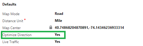
6. Optimize Direction: This option will help the user to create an optimized route by default.
7. Current Location: The user can define the current default location using this option.
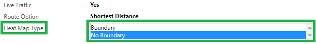
8. Live Traffic: This option allows the user to see live traffic status as default when the route is created.
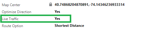
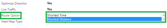
9. Route Option: The user can define the best way to determine a route i.e. Shortest Time or Shortest Distance.
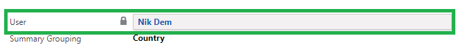
10. User: Name of the user to whom this record belongs to. This is a ‘Read-Only’ field.
11. Heat Map Type: This allows the user to select the default option for Heat Map. Available options are ‘Boundary’ and ‘No Boundary’.
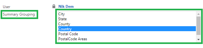
12. Summary Grouping: Default option for the region type.
Maplytics™ is one of the leading geo-analytical mapping apps that provides powerful data visualization capabilities within Microsoft Dynamics 365. Maplytics is one of the first multi-language mapping apps to be Certified for Microsoft Dynamics 365 (CfMD). Maplytics is powered by Bing Maps and runs natively within Dynamics CRM. Maplytics offers powerful features like Appointment Planning, Radius Search, Sales Territory Management, Route Planning, Heat Maps and more to take your MS Dynamics CRM visualization to an entirely new level! Maplytics currently supports English, French, German, Portuguese, Spanish and Turkish.
Get your FREE TRIAL today!
Happy Mapping!


