The holiday season is upon us and 2020 has its bags packed ready to leave! We know this year was marked by some really dark events and the world was locked away tight for most of the year but it finally gave us all a chance to stop, reassess ourselves, reprioritize our goals, and finally come back mentally stronger, smarter, and more resilient. The experience was the same for us. Our Maplytics team stuck together through the tough times, we put our heads down and continued to focus on innovating and pushing ourselves to reinvent and improve the productivity of your mapping solution.
With the constant stream of brainstorming for new features and considering recommendations, suggestions, and requests, we’re delighted to share that our efforts were a success! We released some great improvements and features for Maplytics this year and we wanted to share the highlights with you. Here are the top features and updates we made in 2020:
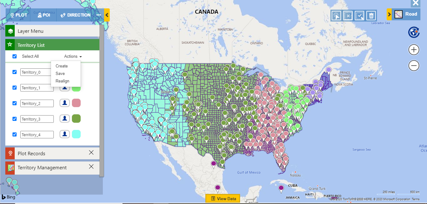
Breaking up large geographical regions into territories and managing them is a large and vital job role of a manager. However, intelligent and balanced workload distributions can prove to be a challenge. Maplytics steps up to this challenge and now allows managers to Auto Create Territories and easily obtain well distributed territories in an instant. Managers can create the desired number of balanced territories based on the count of records within the required region automatically. Talk about smart and convenient!
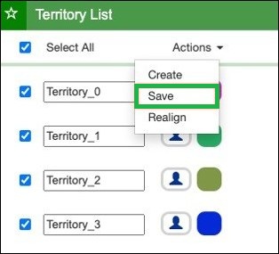
For the times when managers want to want to incorporate the opinions of another member regarding the territories or if they need to rework further, Maplytics allows them to simply save their territories as drafts and continue their work where they left off.
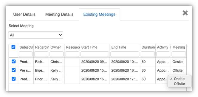
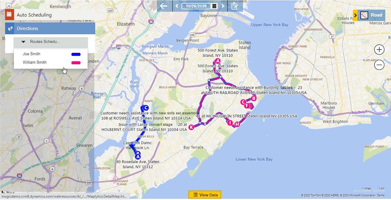
Auto Scheduling has been wildly successful with business due to its ability to leap productivity to another level. With the updated Advanced Auto Scheduling feature, users can create Auto Schedules for multiple users at once, consider their existing meetings, and even customize the duration of meetings for individual users! The multiple schedules can be viewed individually or all at once on the map, differentiated easily by color coding each route differently for individual users.
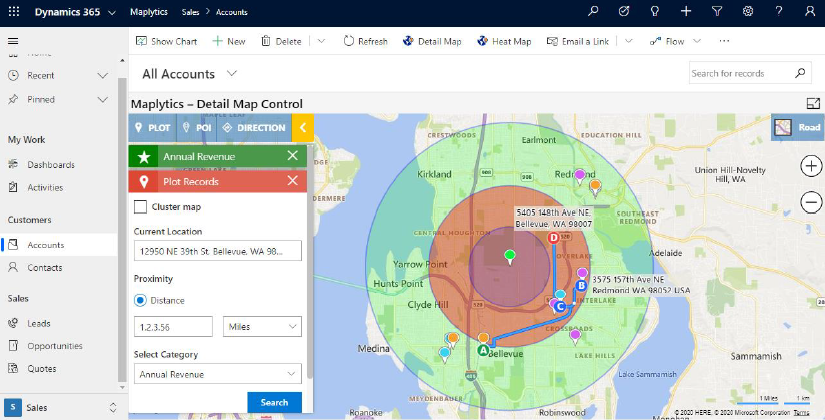
Want to save time and also have usability convenience? PCF Controls allows users to visualize all the records of view, sub-grid or dashboard by adding PCF controls to any entity or dashboard. In the latest update, users can control the Detail Map Control directly without leaving their current screens. Users can even highlight multiple pushpins at once and apply any user action on them from the ribbon.
With Detail map control user can perform these Maplytics features:
- Plot entity records
- Plot categorized data
- Proximity search
- POI locations
- Routing
#4: Truck Routing
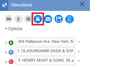
Do you see heavy trucks riding besides you on your everyday routes? No? That’s because commercial vehicles have a different path which they have to take for everyone’s safety. Because of their size, permit issues due to hazardous materials, speed limitations on certain routes, road conditions, tolls, etc. trucks are instructed to navigate through an alternate suitable path. Maplytics Truck Routing feature now allows you to map this path automatically for your trucks. This allows your drivers to have a safe, regulation compliant, and optimized roadmap charted to their destination, allowing them to make timely deliveries. Truck Routing proves to be a huge time, effort, and money saver for the management as well as drivers where logistics play an integral role.
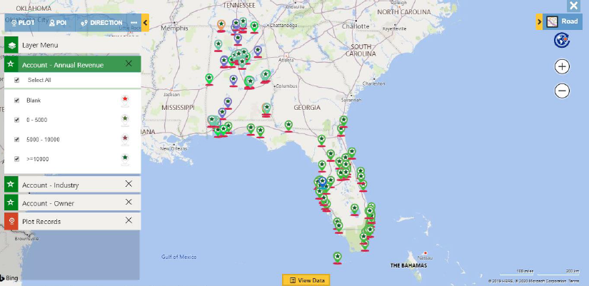
Data visualization got more sophisticated. Users can now select three categories for a single entity. So let’s say an Account entity is selected, users can choose three categories like shown in the screenshot. Even different pushpins can be assigned to different categories. While the data is plotted there will be an overlap of these pushpins for the view.
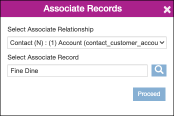
Associate Records makes it simple and straightforward to associate a record with the plotted record(s) on the map. Users can select the relationship through which they want to associate the records. The default record will be selected according to the record from which the map was opened.
#7: Search POI Locations with Keyword
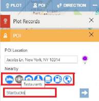
Point Of Interest has been a popular and widely used feature of Maplytics where users can plot their Point of Interest locations on the map. Adding to the usefulness of this feature, users can now even enter their required POI directly in the search bar. This allows for a faster search and pinpoint of the location on the map.
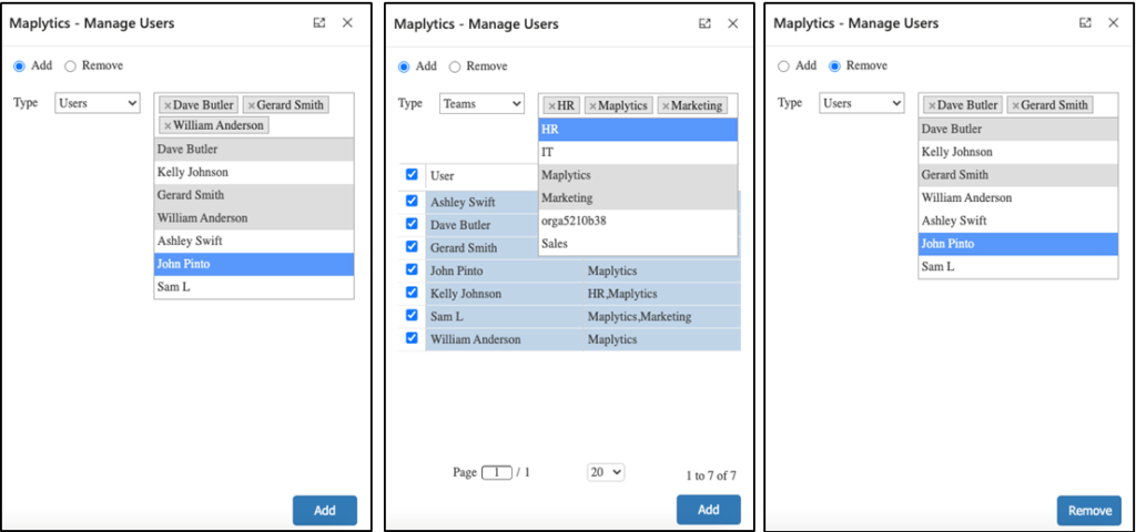
Security Templates allows admins to provide selective access of Maplytics actions to Maplytics users as per their respective requirements. With the latest update, admins can grant or deny selective access to multiple users or teams at once using ‘Manage Users. This saves time and effort by allowing the ability to manage access in bulk.
So that’s all the new goodies for this year but be assured that you will hear more good news from your Mapping experts with exciting surprises for you in the bag for 2021! Lastly, we would like to acknowledge that this constant innovation and iterative progress would not be possible without your feedback, suggestions, and requests. We thank you for helping us in this innovation journey J!
Until the New Year comes around –Team Maplytics wishes you merry visualizations and happy new data insights!

